CONTENT
BeiDou Navigation is China’s independently developed satellite system for positioning, navigation, and time synchronization. Officially called the BeiDou Navigation Satellite System (BDS), it provides global coverage. Compatible equipment can also access services such as precision corrections and satellite messaging.
The shorthand Chinese GPS system captures its basic purpose. Its commercial significance extends into how machines coordinate work, exchange information, and maintain service in remote locations. Useful questions include which capability a business needs, what equipment enables it, and how performance holds up in real operations.
A receiver calculates its location from satellite signals carrying timing and orbital information. Ground infrastructure monitors and maintains the system. BeiDou-3 provides global service within the broader GNSS (global navigation satellite system) category.
The BeiDou satellite system uses a mixed satellite constellation. It combines medium Earth orbit spacecraft with geostationary and inclined geosynchronous spacecraft.
The BeiDou navigation system supports different service footprints. The same system can include a global navigation signal and a regional correction service. A product evaluation therefore needs the coverage map for the particular service being purchased.
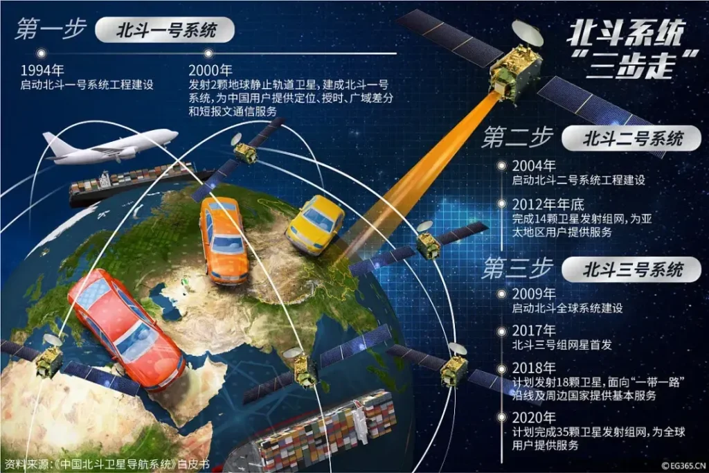
BeiDou and GPS both provide global positioning and time information. Their national ownership and constellation designs differ. Compatible receivers can process signals from both.
| Comparison | BeiDou | GPS |
| National system | China | United States |
| Basic coverage | Global | Global |
| Orbital design | Mixed medium Earth, geostationary, and inclined geosynchronous orbits | Medium Earth orbit |
| Combined use | Can contribute measurements to the same receiver solution | Can contribute measurements alongside BeiDou |
The current constellation register documents orbital differences. A 2025 study in Satellite Navigation describes correction services involving both systems.
For procurement, a GPS vs BeiDou comparison should use the same receiver class, correction method, environment, and measurement criteria. A consumer phone and a corrected survey receiver answer very different performance questions.
Unicore’s March 2026 system update lists global positioning better than 10 meters. It separately lists precise point positioning better than 0.3 meters horizontally and 0.6 meters vertically. These figures describe different service capabilities.
PPP-B2b delivers satellite orbit and clock corrections through geostationary spacecraft. The July 2025 technical study describes coverage across mainland China and neighboring areas, with corrections arriving by satellite. This reduces dependence on an internet connection for that correction stream.
One less discussed detail deserves attention: PPP-B2b correction messages can support GPS measurements as well as BeiDou measurements. The commercial implication is that a buyer can combine capabilities from both systems in a compatible product.
For precision positioning, practical questions focus on correction availability, convergence time, and recovery after an interruption. Convergence is the period required for a precise solution to settle. A machine that repeatedly loses its solution may deliver poor productivity despite an impressive best-case accuracy figure.
BeiDou is used in crop-spraying drones, seeders and tractors. According to the China Association of Satellite Navigation and Positioning, China’s agricultural sector has cumulatively deployed more than 2.7 million BeiDou terminal devices or sets.
The operational detail is more instructive than the total. ComNav described combining satellite measurements with ground correction data to guide machinery. It also described work on shared field maps, allowing later weeding and harvesting operations to follow earlier planting tracks.
That creates a practical test for equipment partnerships: can machines exchange usable field coordinates across successive jobs? Repeatable routes, compatible data, and operator training deserve a place beside hardware specifications in purchasing decisions.
During the 2025 spring plowing season in Heilongjiang, unmanned farm machinery guided by BeiDou navigation achieved cultivation accuracy better than 2.5 centimeters, with operational efficiency rising more than 30%.
At Tianjin Port and Ningbo-Zhoushan Port, BeiDou combined with 5G and inertial navigation enables unmanned container trucks to dock with centimeter-level precision, lifting port efficiency by over 30%.
BeiDou messaging has industrial applications beyond personal emergency communication. A Heshuo County government report published in August 2025 describes a State Grid deployment in Xinjiang using third-generation BeiDou short messages to control distribution equipment without terrestrial network coverage.
Dispatchers could receive fault information and remotely operate distribution switches. The terminal connected satellite communication with an existing electricity workflow.
The business implication is specific: evaluate satellite messaging for small, essential exchanges, such as equipment status or control instructions. Message capacity, delivery confirmation, and the response procedure determine its usefulness. A remote-control deployment also needs communication-capable equipment, beyond standard positioning reception.
In January 2025, the Chinese Academy of Sciences reported that its monitoring system routinely assessed BeiDou timing services against China’s national standard time. This illustrates an operational requirement that map-centered explanations can overlook.
A synchronized system needs confidence in when an event occurred. For a timing deployment, procurement should examine clock monitoring, alarms, and behavior during signal loss. A successful location demonstration provides little evidence about those requirements.
Xinhua reported that the system’s in-orbit upgrade was completed on July 31, 2026, citing the China Satellite Navigation Office.
The practical preparation appeared in manufacturer notices. In April 2026, CHC Navigation addressed the planned retirement of seven BeiDou-2 satellites and the discontinuation of the B2I service. It reported validation across its product portfolio and preparation of firmware updates.
CHCNAV expected consistent performance in routine conditions, while noting that fix availability could decline slightly in heavily obstructed settings. That qualification matters when a product operates around buildings, forests, or deep terrain.
The lesson for logistics equipment and autonomous driving projects is lifecycle support. Ask suppliers to identify supported signals, document update delivery, and provide field results for the intended operating conditions.
For long-lived deployments, request a written support period and a process for validating firmware before a fleet-wide rollout. Contracts should also identify who investigates failures when the receiver, correction provider, and machine integrator are separate companies.
The 2026 industry white paper coverage published by China’s satellite navigation association reports 2025 satellite navigation output of RMB 629 billion [US$92 billion], up 9.24%.
It also reports a broader space-and-time services industry worth RMB 1.3323 trillion [US$195 billion]. That expanded category includes technologies such as remote sensing, geographic information, mobile communications, and indoor positioning.
The distinction changes market interpretation. The larger figure covers a wider industrial definition, so comparisons with earlier navigation-only totals require matching scope.
For a commercial assessment, define the addressable activity first: receivers, correction subscriptions, machinery integration, or application software. Then examine customer demand and service economics within that activity.
China’s progress becomes more useful to study when the analysis follows the full path from satellite capability to a working product and a paying customer.
BeiDou Navigation raises practical questions about how Chinese infrastructure becomes a commercial service. ChoZan offers China research, workshops, expert calls, and learning expeditions. Explore our China reports or discuss a focused research question about technology adoption and business models, or book a consultation.
Yes. Apple’s iPhone 17 specifications, for a model introduced in 2025, list BeiDou alongside other positioning systems. Check the specifications for your exact model before assuming support, since hardware capabilities vary across devices.
Usually, you don’t need a separate app on a compatible smartphone. Satellite support comes through the device’s positioning hardware. Your navigation app accesses system location services, subject to permissions. An app download cannot add missing receiver hardware.
Yes. A compatible receiver can obtain satellite positioning signals without mobile data. Map content is a separate requirement. Download supported offline maps before traveling, and check that your chosen application offers offline guidance for the destination.
A receiver may need current satellite orbital data before calculating its first position. Assisted positioning can obtain that information through a faster connection. Obstructions and outdated assistance data can extend the wait after startup.
Ordinary satellite positioning reception does not itself transmit your location back to the constellation. Manufacturers describe receive-only chips. Apps and connected services can share information separately, so review device permissions and provider privacy policies.
Direct satellite reception can weaken or disappear indoors. Walls and roofs obstruct signals. As Apple explains, phones may continue estimating location through other inputs, including Wi-Fi and cellular networks. Indoor performance depends on the complete positioning setup.
There is no universal guarantee. Signals from different constellations can share frequency bands, so interference can affect several systems at once. NovAtel’s 2025 technical explanation shows why receiver interference mitigation matters alongside support for multiple constellations.
BeiDou currently has 50 operational satellites in orbit. The 59th and 60th BeiDou navigation satellites, two BeiDou-3 MEO satellites launched on September 19, 2024, feature upgraded onboard atomic clocks and new inter-satellite-link terminals and are also being used to test technologies for the next-generation BeiDou system.
A phone’s positioning compatibility does not mean it can make satellite calls. Huawei lists BeiDou messaging and Tiantong communication separately. Check the handset, software version, carrier, and supported service before relying on satellite voice communication during travel.
China’s stated goal is a more integrated space-and-time infrastructure before 2035, according to a July 2026 official update reported by Xinhua. Treat that as a development objective; assess present purchases against services and equipment available today.