CONTENT

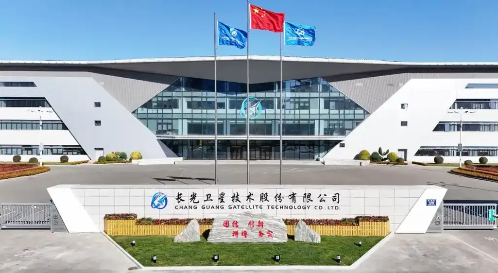
Chang Guang Satellite is the Changchun-based company behind the Jilin-1 constellation, a Chinese commercial Earth observation network. It develops satellites and supplies imagery and related information services. Xinhua reported in September 2026 that the company had launched 161 satellites for the network.
Its business relevance spans crop monitoring, mapping, and automated image analysis. The company offers a useful case study of China’s ability to connect hardware development with practical data services. Its value deserves close examination through delivery quality, documented applications, and commercial access.
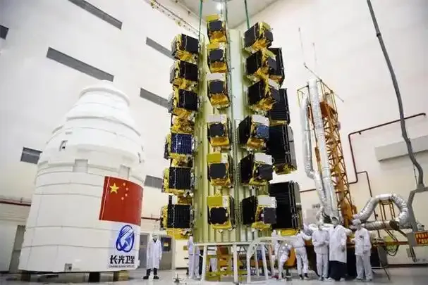
Chang Guang Satellite Technology Co. Ltd. (CGSTL) operates across spacecraft development, imaging, and data applications. Its current product portfolio includes satellites, optical payloads, components, and customized satellite manufacturing services.
This structure connects engineering decisions with the information customers receive. Camera design influences image detail; spacecraft control affects collection quality; processing determines how quickly those images become useful.
The distinction matters when evaluating CGSTL. A satellite supplier sells hardware. An imagery service must also manage collection, quality checks, processing, and delivery. Customers should establish which parts of that chain a proposed contract actually covers.

CGSTL reports that 161 Jilin-1 constellation satellites have been launched. Its June 15, 2026 announcement identified that successful mission as the programme’s 37th launch.
Assessing service capacity also requires an active satellite inventory, available sensors, orbital coverage, and tasking commitments. Buyers should request those details for their location and delivery window.
This distinction prevents expansion targets from becoming assumed capacity. A proposal should identify the deployed satellites that can fulfill the order and the service terms available today.
Planned spacecraft can inform a supplier’s development direction, while the existing service must support the purchase decision.
In March 2025, CGSTL announced national image updates every two months at 0.5-meter resolution. The first release covered January and February 2025, with a company-reported effective coverage rate above 99.4%.
This announcement describes a China-wide image service. It does not establish an equivalent global update schedule or an individual customer’s delivery guarantee.
The commercially significant development was the release schedule. A predictable image layer can support recurring comparisons across a property portfolio or infrastructure network. Customers still need capture dates for individual locations, since a nationwide image mosaic can combine observations collected on different days.
A February 2026 report described nighttime color imagery captured in January at better than 0.5-meter resolution. The example showed an illuminated attraction in Changchun.
This provides a recent example of high-resolution imaging beyond daytime collection. Nighttime optical satellites still depend on scene illumination and observing conditions.
A clear procurement brief separates three requirements:
| Requirement | What it establishes | What to request |
| Spatial resolution | The ground detail represented in an image | A sample showing the actual feature you need to assess |
| Revisit opportunity | How frequently a satellite could observe the location | A collection assessment for the relevant coordinates and season |
| Delivery latency | The interval before usable data reaches your system | Written timing for collection, processing, and delivery |
Clouds can block optical observations, a limitation ESA discussed in November 2025. A frequent overflight schedule therefore requires a separate assessment of usable image availability.

Xinhua’s September 2026 agricultural reporting described Jilin-1 applications in crop distribution, acreage monitoring, farmland protection, and disaster assessment. A provincial agriculture official explained that satellite information helped assess farmland affected by severe weather that summer.
The same report described a farm combining satellite observations with soil sensors, field cameras, and drones. Its management system flagged crop conditions for further checks.
The practical lesson is integration. A crop alert becomes valuable when someone can inspect the affected plot and act. A business should define that response before commissioning commercial imagery.
The same planning discipline applies to other proposed uses. For example, a construction-monitoring pilot should specify the physical change that warrants inspection, the evidence needed to confirm it, and the person responsible for follow-up.
A July 2025 research preprint, authored by researchers affiliated with CGSTL and Jilin University, introduced CGEarthEye. The work described a vision foundation model framework built around Jilin-1 imagery and evaluated it across 10 benchmark datasets covering four image-analysis tasks.
Its seasonal training approach is the more revealing detail. Images of the same area change as vegetation, lighting, and seasons change. The research uses seasonal comparisons to improve image representations.
The strategic inference is that an imagery archive can support model development as well as image sales. Repeated observations give researchers material for learning how places change.
These are author-reported research results. A company considering AI satellite data services should test performance against its own sites and definitions of change. A benchmark result cannot establish how reliably a model identifies a particular warehouse extension or damaged crop.
Commercial access requires attention alongside technical performance. CGSTL is listed on the U.S. Treasury’s OFAC Specially Designated Nationals and Blocked Persons (SDN) List.
On May 8, 2026, OFAC added an Iran-related sanctions designation alongside its existing Russia-related designation. U.S. persons are generally prohibited from dealing with SDNs unless an applicable authorization or exemption exists.
Potential transactions require a current assessment of applicable restrictions, counterparties, payment routes, and end use. An accessible image catalog does not establish transaction eligibility.
This constraint belongs in any serious account of China’s imaging capabilities. Technical progress and international market access follow different rules. A company can study the operating model while evaluating any proposed purchase or partnership separately.
A July 2026 financing report identified three intended funding priorities: production capacity, constellation deployment, and data applications. Together, those priorities show how the company plans to connect manufacturing scale with customer services.
The broader lesson from China is coordinating those activities. Better spacecraft create potential value; repeatable collection and processing help turn that potential into a product.
A useful next step is a small, measurable pilot. Choose one location, one decision, and a deadline. Compare the resulting geospatial data with a verified site record, then measure missed changes, false alerts, delivery time, and the work required to interpret the result.
The cost comparison should include analyst time, integration work, repeat collections, and exception handling. A low image price can still produce an expensive workflow. The more useful metric is the total cost of obtaining an answer early enough to change an action.
Chang Guang Satellite raises a broader question: which Chinese technology models can inform your next business decision?
ChoZan offers China research, digital transformation training, and China innovation tours with itineraries tailored to business interests. Our Top 25 Chinese Tech Innovators report provides another starting point for examining recent company developments.
Explore these resources, then contact us to discuss a focused research or learning brief tied to your business priorities.
Changguang Satellite is a spelling variant associated with CGSTL. OFAC’s 2026 record lists both spaced and joined company-name forms. Match legal identifiers and addresses when checking a supplier, since transliteration alone cannot verify an entity.
Jilin-1 serves imaging and observation applications. Its name should not be read as a consumer broadband offer. Ask suppliers to identify the specific image or information product being proposed, rather than relying on constellation branding.
A reliable price requires a project-specific quotation. State the area, dates, image detail, processing needs, and intended use. Ask the supplier to separate collection, processing, licensing, and delivery charges so you can compare competing offers fairly.
Ask the supplier to check coverage and minimum order requirements for your property boundary. A small site may sit within a larger image footprint. Confirm the billable area and request a preview before authorizing an order.
Archive imagery already exists from an earlier collection. New tasking requests another observation. Start with an archive search when a historical date suits the project; request tasking when the required event or time window needs fresh coverage.
Panchromatic imagery records a broad light band, while multispectral imagery separates several wavelength bands. Ask which bands your analysis needs and their native resolution. A sharp color preview alone cannot establish suitability for a specific analytical task.
Request the image format, coordinate reference system, acquisition metadata, and processing description before purchasing. Ask for a sample import into your geographic information system. Confirm that your team can open, align, and interpret the delivered product.
Check the license before publication. Ask specifically about website display, attribution, image editing, audience limits, and access through third-party platforms. Internal analysis rights may differ from publication rights, so request written terms covering your intended use.
Request explicit terms covering model training, derived datasets, retention, and sharing of outputs. Access to image files alone does not establish those permissions. Describe the planned training workflow so the supplier can address each required use.
Resolution describes the ground sampling detail in an image. Map accuracy concerns how closely mapped positions match their true locations. Ask for the product’s positioning specification and validation method when precise measurements or boundary alignment matter.